
PHOENIX AIR UNMANNED, LLC
Light Detection and Ranging (LiDAR)
Phoenix Air Unmanned (PAU) provides engineering and survey firms with high-accuracy drone LiDAR data and low turnaround times. Our unmanned aircraft-based aerial survey acquisition method allows for high fidelity of large areas of interest and improves upon traditional inspection techniques. We are experienced in applying this technology to land mapping and infrastructure aerial inspection across the United States. PAU has paired drone LiDAR with high-resolution RGB cameras to colorize the point cloud -- further detailing the area of interest. In addition, orthomosaics can be generated from the imagery collected, providing end users with another level of visualization for their particular project.
Remote LiDAR Acquisition Services
Phoenix Air Unmanned (PAU) drone LiDAR assets are based in Cartersville, Georgia -- 45 minutes north of Atlanta, Georgia. PAU collects LiDAR data in the southeast United States and beyond, even taking on international projects. We provide drone LiDAR services for aerial survey and engineering firms in Georgia, Florida, Tennessee, Alabama, Mississippi, South Carolina, North Carolina, and Louisiana.
LiDAR collection flights for utilities have spanned the Midwest from North Dakota down to New Mexico. These drone LiDAR flights include greenfield, brownfield, and vegetation management acquisitions.
PAU mobilizes for much less than the cost of traditional manned aviation helicopter and fixed-wing assets. Past projects range from tens to thousands of acres of coverage -- all conducted within the current regulatory framework by proficient, highly skilled flight crews and sensor operators.
Meeting Deliverable Requirements
The Ranger VUX-1 allows for survey-grade accuracy and multiple returns per pulse to generate a highly accurate and dense points cloud. Our typical projects yield more than 250 points per meter squared delivering leading resolution when project area detail is paramount. Combined with the 100 megapixel resolution of the PhaseOne IXM 100, highly accurate and registered point clouds are created with ground sample distances of less than 1 cm per pixel. We have refined our post-processing regimen to utilize cloud computing algorithms to provide quick turnaround of deliverables.
Photogrammetry
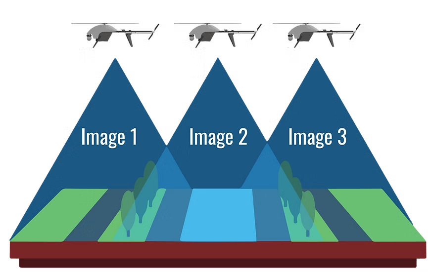
Phoenix Air Unmanned (PAU) provides high-quality photogrammetry solutions. With the ability to produce high-resolution orthographic maps, PAU can support aerial survey and aerial inspection efforts with geo-accurate data. We conduct our mapping flights using the industry-leading 100MP PhaseOne camera while providing centimeter-level accuracy covering even the smallest details. Our photogrammetry solutions include 3D maps, RGB imagery, orthographic maps, thermal imagery, and other multispectral deliverables.
Coverage Across Multiple Industries
Photogrammetry flights with drones can cover hundreds of acres in a day -- making even large-scale projects seem small. From marketing and public safety to mapping and inspections, PAU has a vast amount of experience in both flying and processing a variety of photogrammetry solutions. Past projects include thermal photogrammetry of solar farms, manufacturing facility mapping for new construction and engineering, and aerial surveys.
PAU is an aerial data acquisition company. We are a group of aviators focused on safe, efficient flight operations which capture data of the highest possible quality. We partner with subject matter experts in the fields of surveying, engineering, and inspections to tailor deliverables to end-user needs.
Sample LiDAR Data Download
Drone LiDAR dataset acquired at Phoenix Air Unmanned, LLC headquarters in Cartersville, Georgia. The Riegl VUX-1 was flown on the Freefly Systems Alta X multirotor UAV, The sample data can be downloaded as a .LAS file or viewed through the LiDAR Viewer link.